
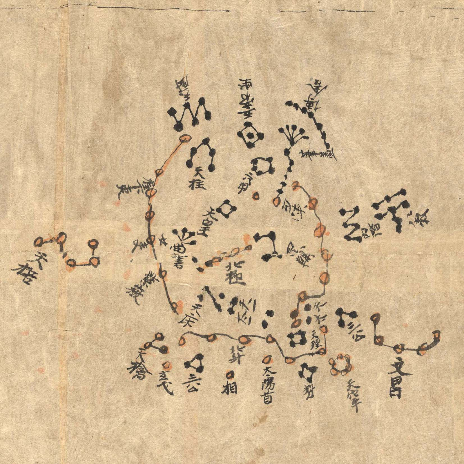
This ancient Chinese map of planet Earth's northern sky is part of the Dunhuang Star Atlas, one of the most impressive documents in the history of astronomy . The oldest complete star atlas known, it dates to the years 649 to 684, discovered at the Silk Road town of Dunhuang in 1907. A recent analysis that examines the accuracy and projections used to make it notes the atlas marks positions of over 1,300 stars and outlines 257 Chinese star groups or asterisms . The star positions in the hand drawn atlas were found to be accurate to within a few degrees. In this example showing the north polar region, a very recognizable Big Dipper , part of the modern constellation Ursa Major, lies along the bottom of the chart. An additional 12 charts depicting equatorial regions in 30 degree sections also includes a group resembling the modern constellation Orion . The atlas is on display at the British Library in London to celebrate the International Year of Astronomy .
Media Credits & Attribution
Credit and Copyright: J.-M. Bonnet-Bidaud ( CEA, Saclay ), F. Praderie (Obs. Paris) S. Whitfield (British Library)